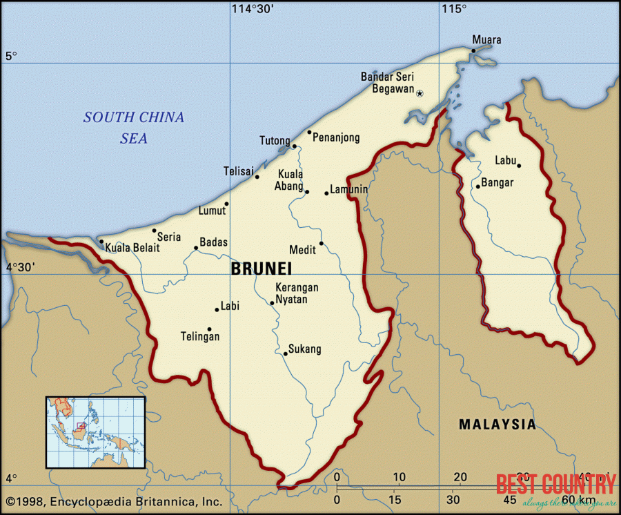
Geography of Brunei

The country lies on the north western region of the island of Borneo between 114 degrees 04' east longitudes and 4 degrees and 30? north latitudes. Brunei is bordered by the South China Sea and Malaysia.
Topography of Brunei, a major aspect of Brunei geography, consists of hilly lowlands in the western region, rugged mountains in the eastern part and swampy tidal plain in the coastal area.
Climate forms another significant part of the geography of Brunei.
Brunei has an equatorial type of climate characterized by high temperature, high humidity and heavy rainfall.
The four rivers of Brunei Belait, Tutong, Temburong and Brunei-Muara, constitute a significant aspect of Brunei's geography.
Geography of Brunei thus, is shaped by the location of the country and the terrain of the land.